Control Descriptions and Map Symbols Explained (2004)
(Samples further down this page)
Control Descriptions are the black on white pictograms that tell you where in the circle the control is located, and Map Symbols are the 5-color symbols used on orienteering maps.
Control Descriptions
Here is a site where you can learn about control descriptions. All the symbols are listed, and you can find out about what each column is for and what information is given on the top and bottom rows.
- Official IOF document on Control Descriptions Adopted in 2004
- Online quiz for learning control descriptions
After you have an idea about how they work you can use the examples below to get some practice using them.
Map Symbols
If you are interested in Orienteering Map Symbols (These are what make up the map. They are similar but not the same as the control descriptions because the map is in color and the control descriptions are only black on white.)
- A one page Legend of the Map Symbols
- The “International Symbols for Orienteering Maps” web version
- The IOF booklet of symbols and printing instructions etc. etc. pdf version
| Tree symbols used on BOK mapsTake a close look at your Umstead Park maps. The trees that have been blown down in the storms are mostly mapped. Here is a small guide to what the different tree symbols mean. | 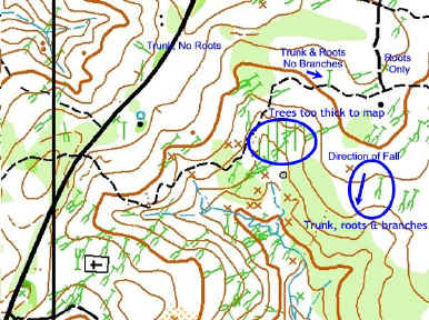 |
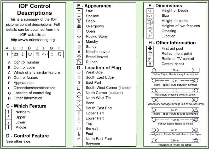
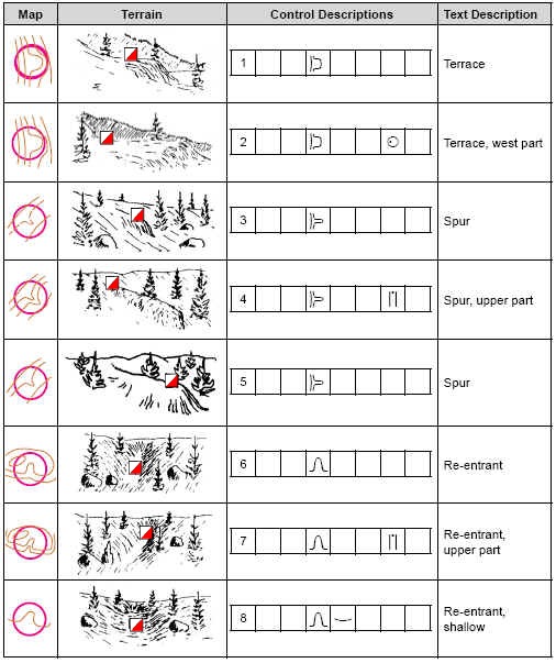
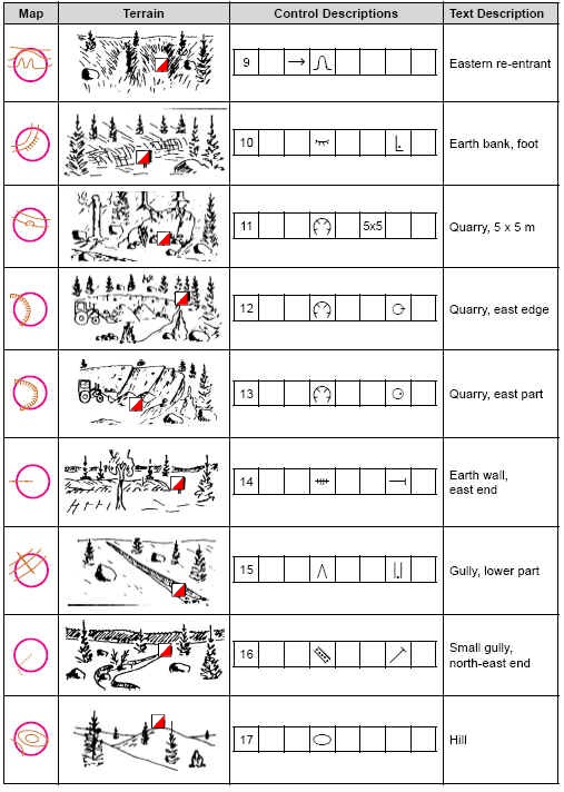
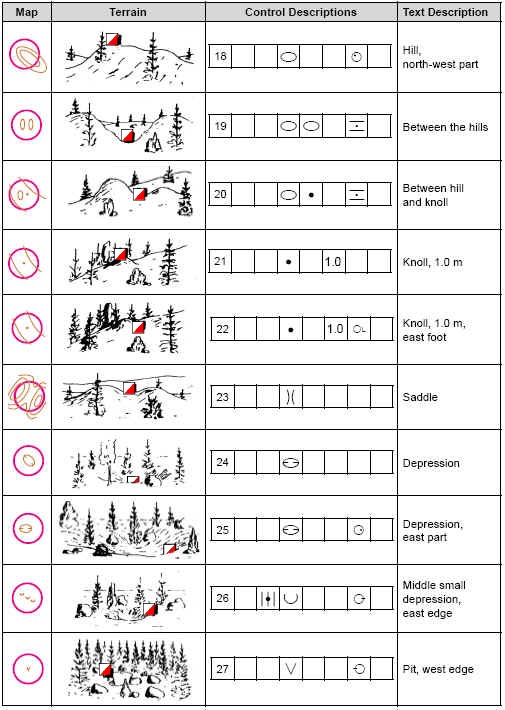
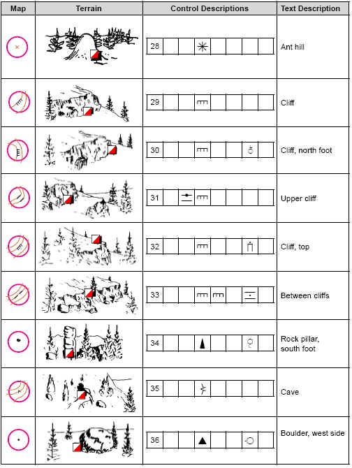
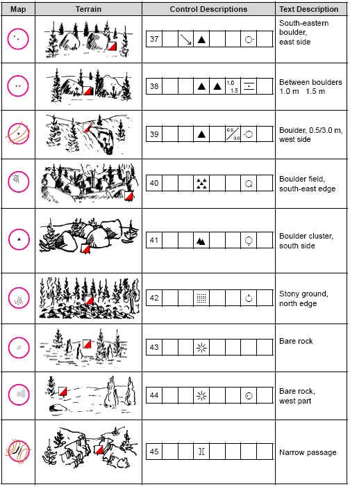
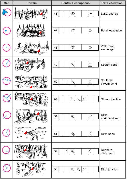
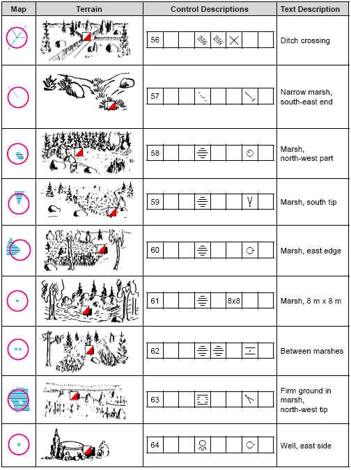
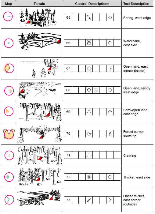
The following sheet shows the Control Description in the left column, followed by the Map Symbol , and then the English translation
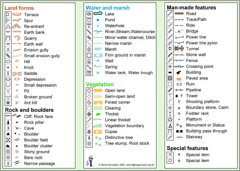
You can download these sheets formatted for printing in a .pdf file
Practice Examples
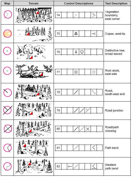
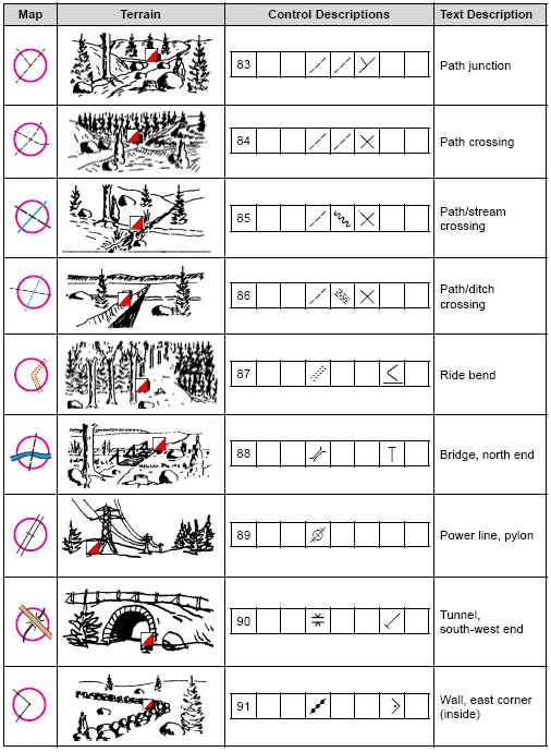
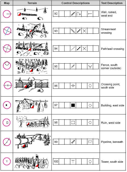
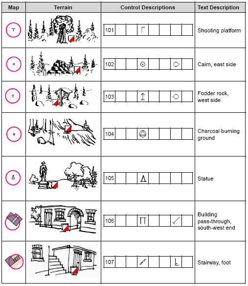
The following example panes are taken directly from the IOF Control Description Booklet pub.March 2004. Here you can practice what you have learned and compare the Map, 3d Sketch, Control Description and the English Words for many examples.
| Map Example |
Sketch | Control Description |
Words |
